
|
|
|
|
08/31/06 |
        
|
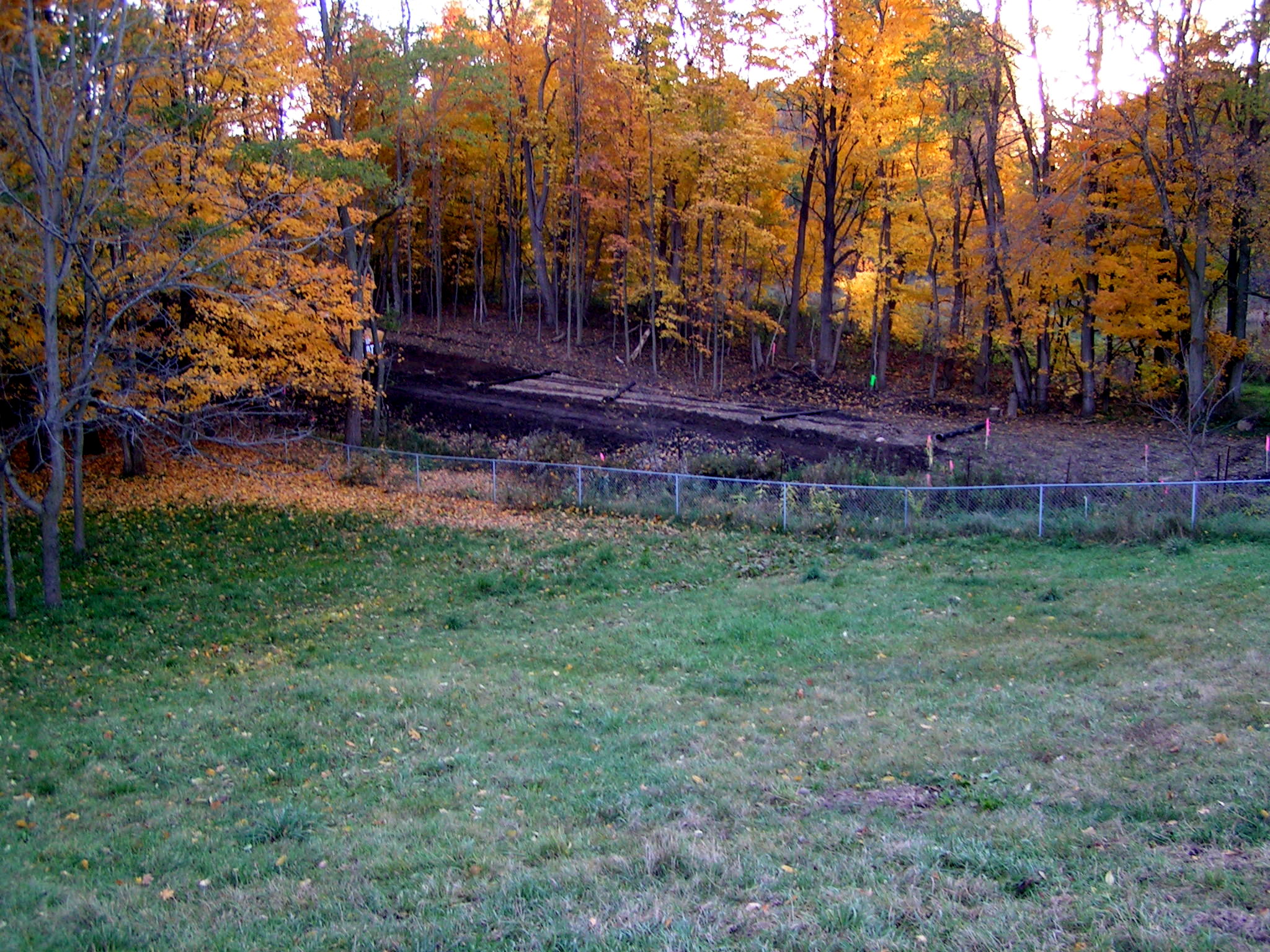
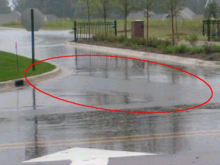
What is this website about? The purpose of this site is the display a photo journal for informational purposes. The photo journals contain the chronological photo history of several changes that have been made to the west and south of our property that has dramatically changed the lay of the land and the ecology of our homestead since October 2004. We are working with the representatives in our area to raise awareness of the changes which have aggregated to create problems with erosion and continuous flooding in our yard. We have been owners of our homestead since 1985. The lay of the land in our yard is such that on rare occasions, after several days of rainfall, a few inches of standing water could collect and overflow from the lowest grade next door (to the west) into our yard. However, this water drained quickly into the ground and was manageable. The number of occasions that this happened over 19 years could be counted on two hands. How has the geography changed to create stormwater problems?
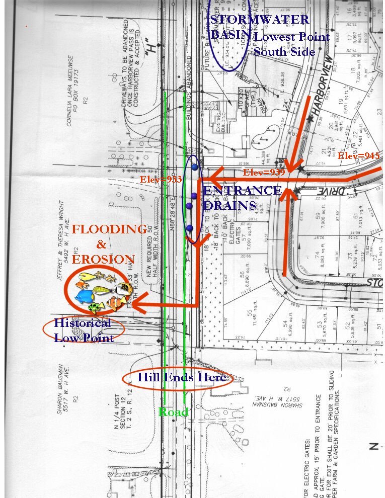
Our Homestead is the only variable that has remained the same. Our home is located on West H. Avenue in Oshtemo Township, Kalamazoo County, Michigan. Our property is the only variable that has not changed - but all of the changes that have taken place around us due to new development and construction have changed the Status Quo.
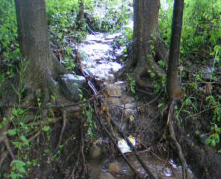
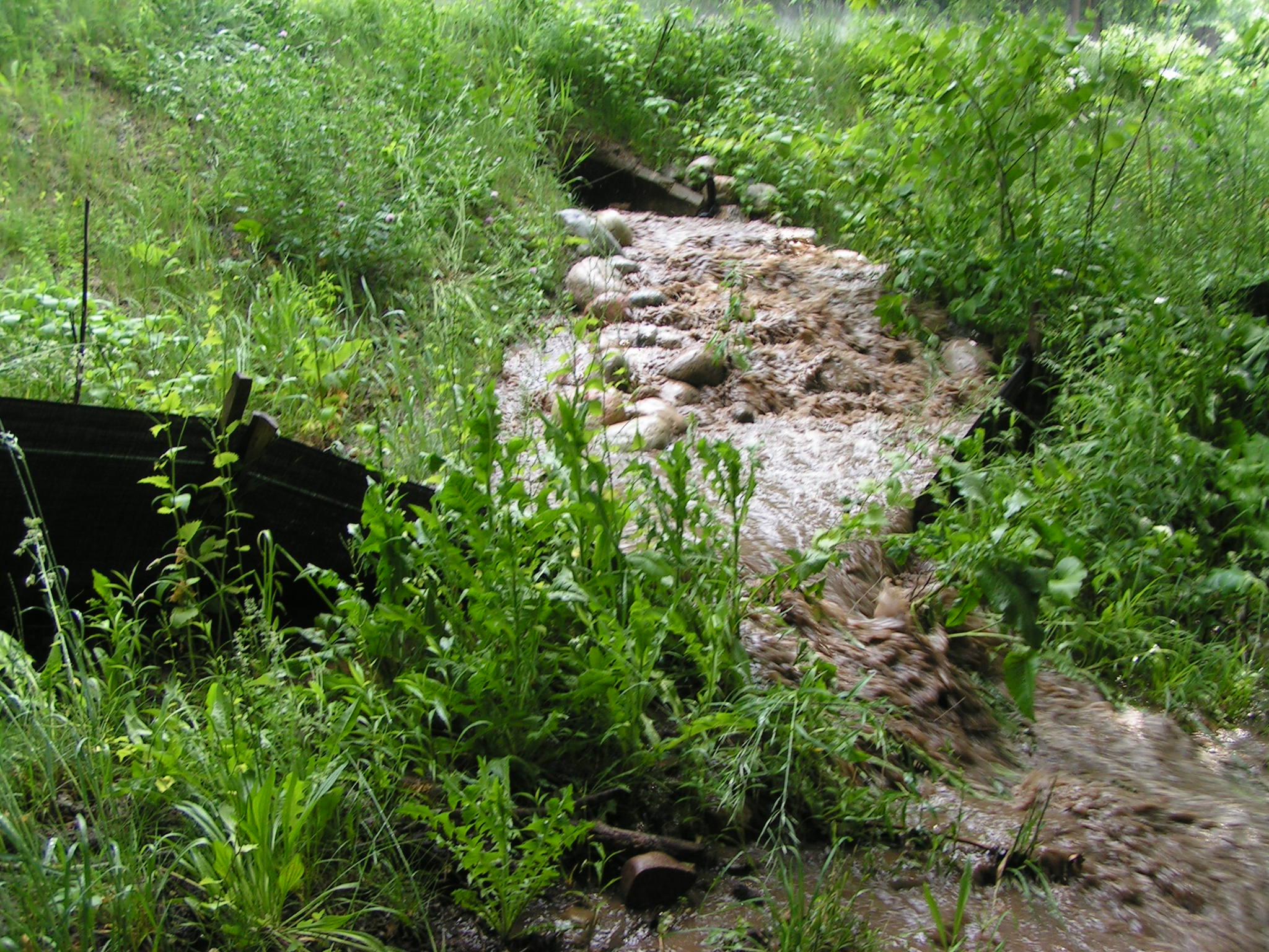
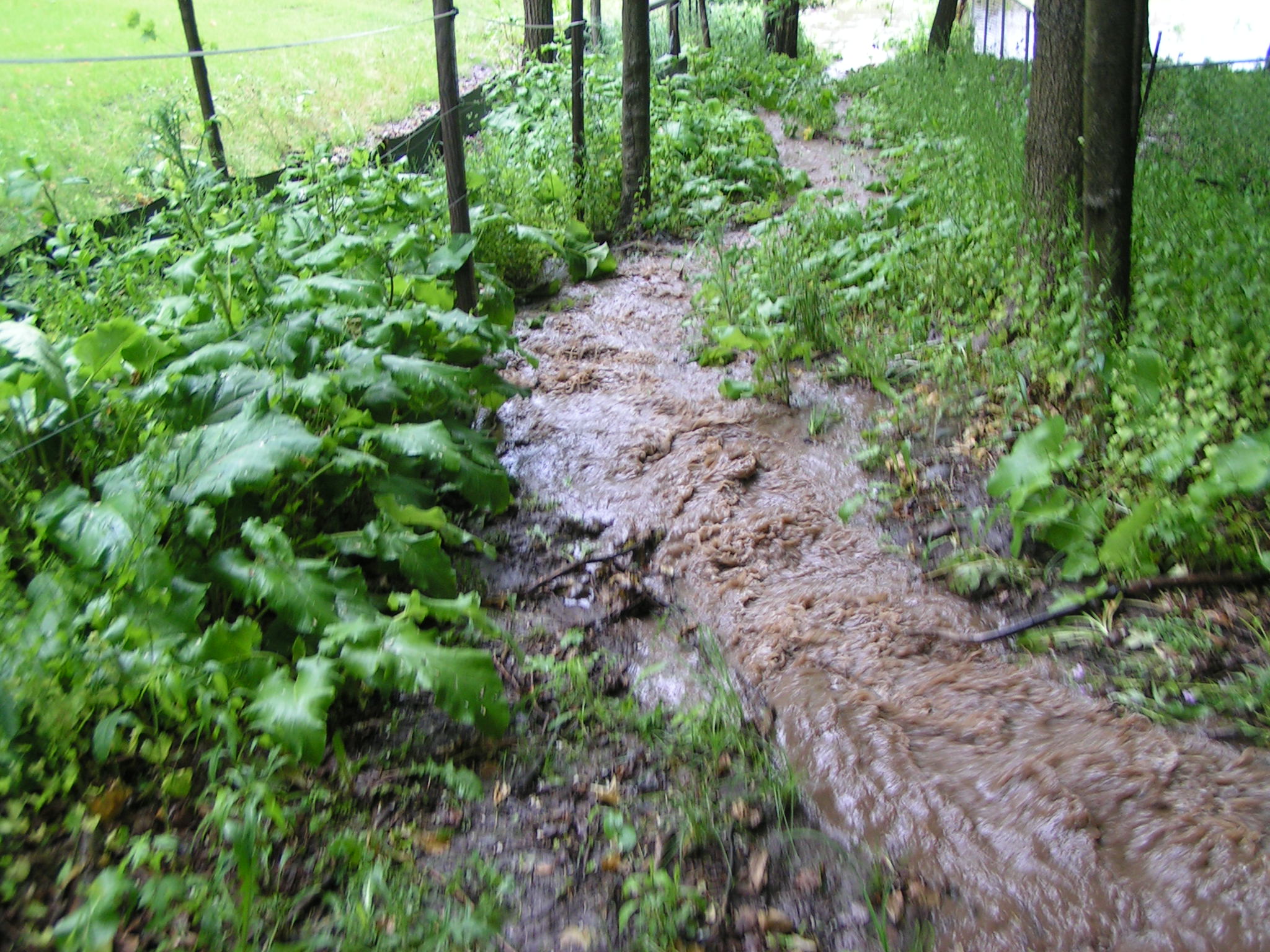
We have tried to line that pathway with rocks picked up from our pastures, but the volume and strength of the water flow churns around them. We have tried replacing the lost soil, but we cannot keep up with the powerful force of the stream from the pipe. Please view
|
This site was last updated 08/31/06
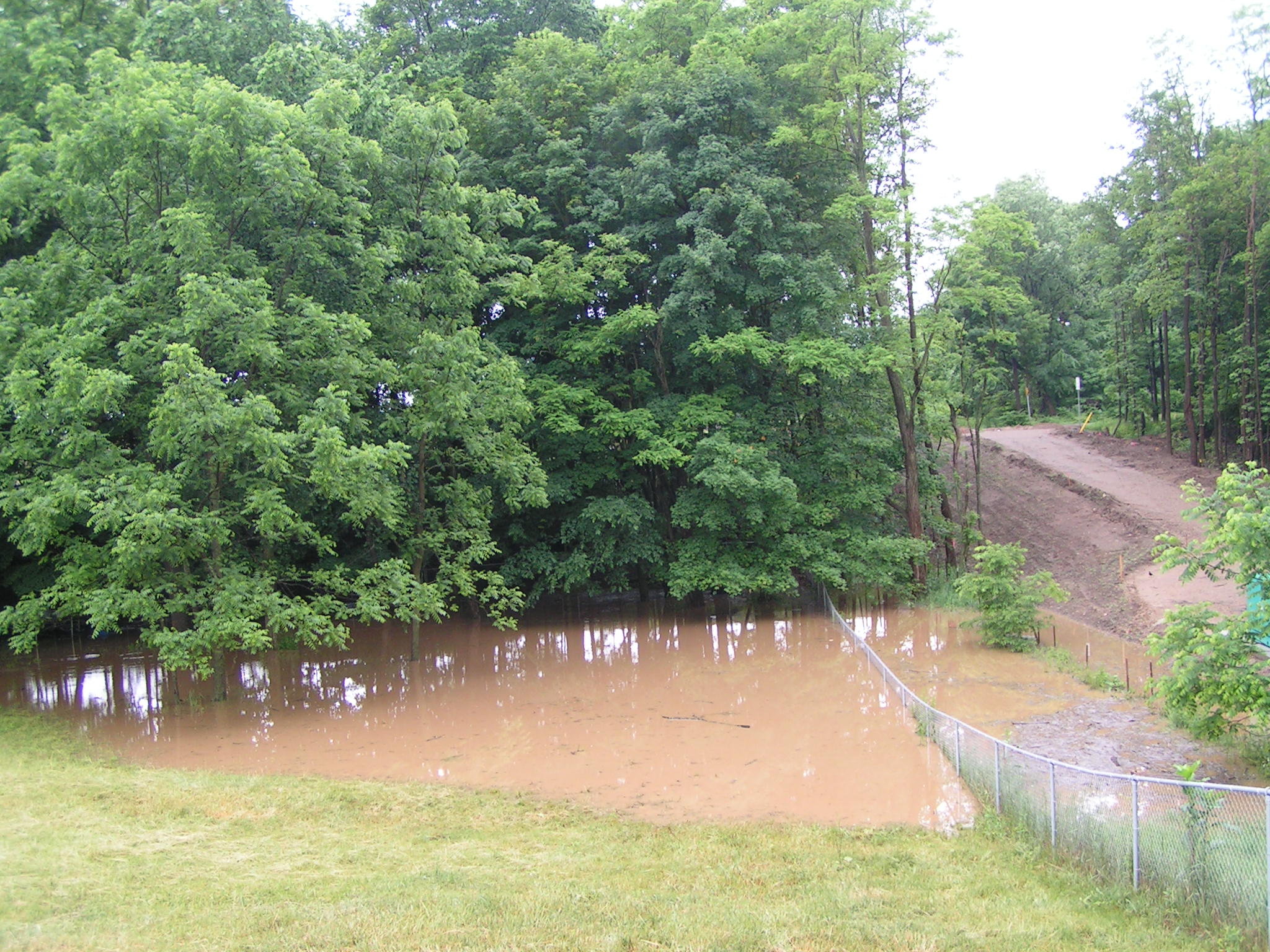
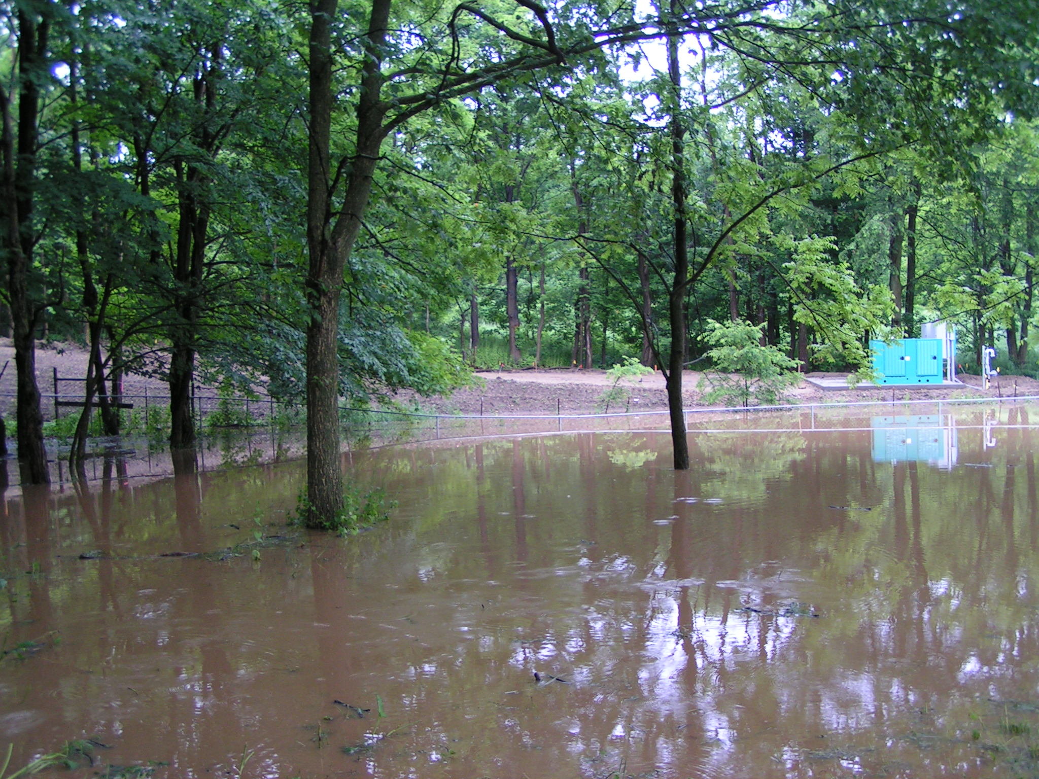
 Erosion and flooding has become a severe
and persistent problem since December 2004, when the pipe under the road was
re-installed. Since that time, soil has been washed away, tree roots are
becoming exposed and stormwater is
flooding our yard. Our livestock, pets and family are constantly exposed to stormwater runoff. The yard is constantly
flooded during the winter and spring months. Dry ground has become a rare event at
this time. The circumstances have been completely reversed.
Erosion and flooding has become a severe
and persistent problem since December 2004, when the pipe under the road was
re-installed. Since that time, soil has been washed away, tree roots are
becoming exposed and stormwater is
flooding our yard. Our livestock, pets and family are constantly exposed to stormwater runoff. The yard is constantly
flooded during the winter and spring months. Dry ground has become a rare event at
this time. The circumstances have been completely reversed.